Measure the lot on an aerial map
Draw areas, lines and measurements on an aerial view of the job and attach the marked up map to the estimate.
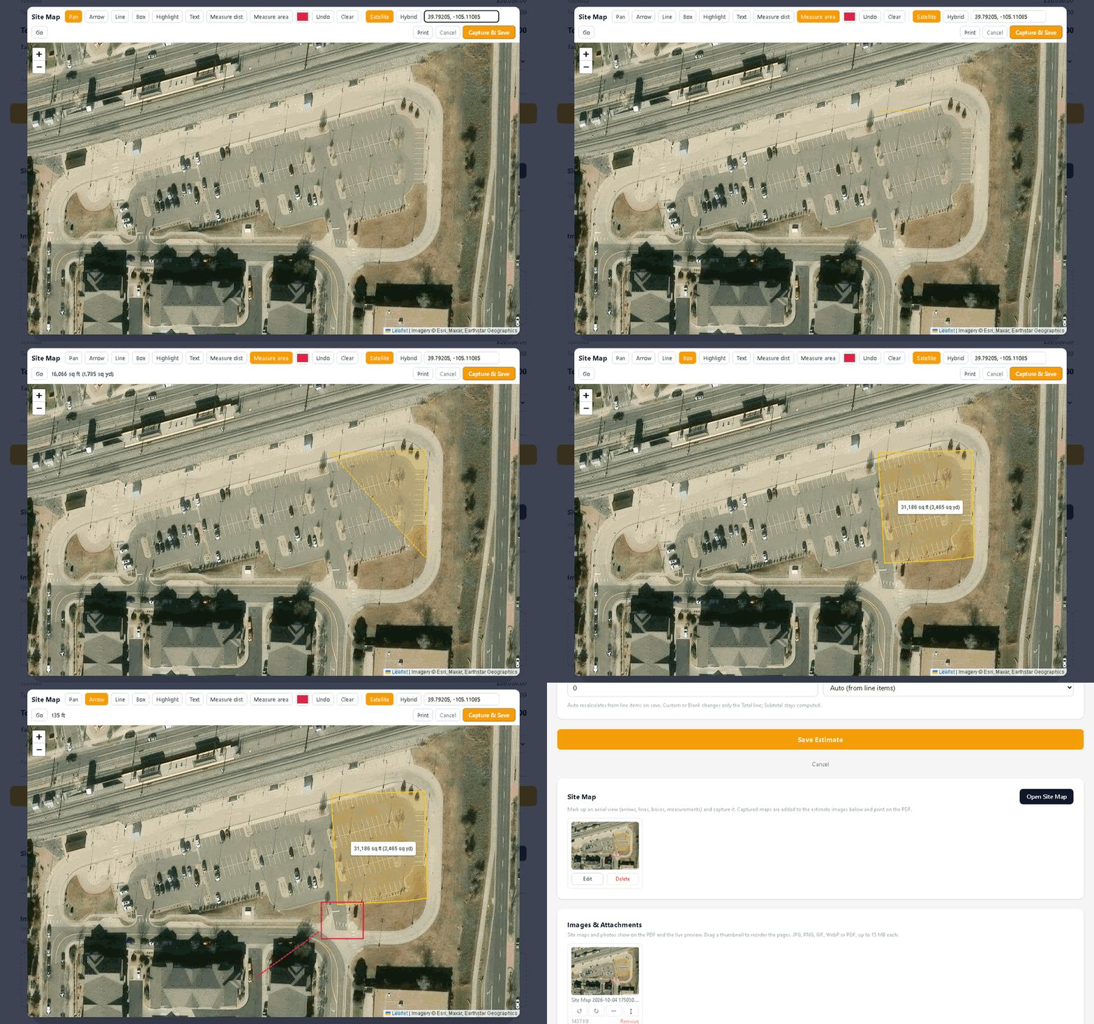
Open Site Map on any estimate, find the address and draw on the aerial view. Areas and lines show their measurements as you draw. Add boxes and labels for the parts that need explaining.
Capture it and the map becomes a page of the estimate. Your customer sees exactly what is included before they sign.